


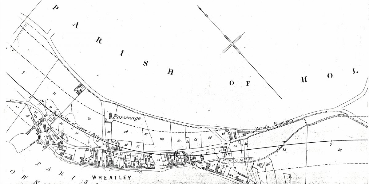
Map showing rail proposal, 1852
See record 2741 for a summary of Wheatley's rail history.
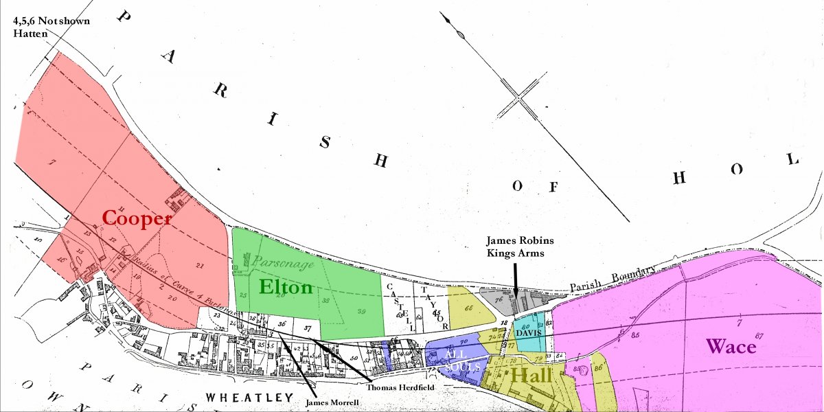
Extracts from map of the original route chosen for the proposed GWR railway line, 1852 (later rejected). Also list of owners and occupiers from which the following is deduced as shown on the coloured-up map. Cooper owned all the quarry and brickworks area including Rock house and Old House, but not the stone pit (now the recreation ground) and lock-up which were owned by the Surveyor of Highways. Rev. Elton had already bought the site for the parsonage and subsequent church and burial ground, but there are a multitude of occupiers of the then ‘garden’ area numbered 39, so was this temporarily let out as an additional allotment? The school was later built on plot 37 owned in 1852 by Thomas Herdfield. The All Souls (College Farm and All Souls Cottage in the High Street) and Hall/Crown Farm are as expected. Rev. Richard Henry Wace owned Ambrose Farm but the Davis family still owned a very small part of this shown in blue.
Cooper owned all the quarry and brickworks area including Rock House and Old House, but not the stone pit (now the recreation ground) and lock-up which were owned by the Surveyor of Highways. By this date Rev. Elton had already bought the site for the vicarage and the subsequent St Mary’s Church and burial ground, but there were a multitude of occupiers of the then ‘garden’ area numbered 39. The school was later built on plot 37 owned in 1852 by Thomas Herdfield. The All Souls College Farm and All Souls Cottage in the High Street are shaded blue, and Hall/Crown Farm is shaded yellow. Thomas Wace owned Ambrose Farm but the Davis family still owned a very small part of this shown in light blue.
- Railway tickets
- A Little Book About Wheatley Station
- Talk by Robert Avery
- Wheatley Station and trains
- Buildings at Wheatley Railway Station
- Wheatley Coal Wagons
- Maps of Wheatley Station
- Map of Oxford- Risborough Railway line
- Photo of railway bridge over the A40 at Wheatley
- Photo of ex-GWR railcar
- Photo of signal at Wheatley
- Photo of Engine 6144
- Photo of approach to Wheatley Station
- Photo of Hartlebury Castle
- Wheatley Station
- Wheatley Station
- Railway timetable, 1935
- Railway timetable, 1950
- Photo of Dukedog engine heading towards Wheatley
- 1928 photo of Wheatley railway bridge over A40
- 19th century handlist of Oxon rail proposals
- Photograph of GWR Dean locomotive
- Photo of railmen
- Picture of Wheatley Station
- Pictures of repair work to Shotover tunnel in Horspath
- Pictures of Wheatley station
- Picture of railway bridge over A40
- Picture of train at Wheatley
- Three pictures of Wheatley station
- Further views of Wheatley's railtrack
- 1955 goods engine at Wheatley
- Two views of Wheatley station
- Two views of Wheatley station sign
- Photograph of Wheatley signalman
- Further pictures of Mr Ladbrook
- Photos of railway personnel at Wheatley
- Wheatley's last train
- Wheatley-Risborough ticket
- Wheatley's rail relics
- Closing the line and demolishing the Ladder Hill bridge
- Working a single line railway
- Edward Elton and the first railway in Wheatley
- Disused railway line 1987
- Towersey Halt
- Eight rail photgraphs taken at Thame station
- Eight rail and other photographs at Morris Cowley
- Rail photographs taken at Littlemore
- Five Railway photographs at Oxford (1950s)
- Proposed new railway link
- Wheatley station at the turn of the century
- Booklet of eight views of Wheatley c.1950
- The Hinton Collection of early postcards of Wheatley - 1913-1915
- Wheatley Station circa 1910
- Photographs from 'Oxfordshire Railways'
- Photographs of London bound train
- 'Up Platform'
- Wheatley Station 1963
- Wheatley Station and Saw Mill
- Wheatley Station
- Wheatley Station
- Recollections of Wheatley GWR by Robert Avery
- Photo of Wheatley station & wood yard
- Railway Station
- Littleworth Railway Tunnel
- Wheatley Rail Station plan
- Line of old railway on modern map
- Rail network
- Window taken from station-master's house
- Wheatley station with Avery's sawmill evident
- The coming of the railway to Wheatley
- Rail motor-car service
- Railway at Wheatley - various posts from third parties
- Assorted press cuttings from 1980 to 1982
- Wheatley's railway history