


Artist's representation from the Cary map of 1820
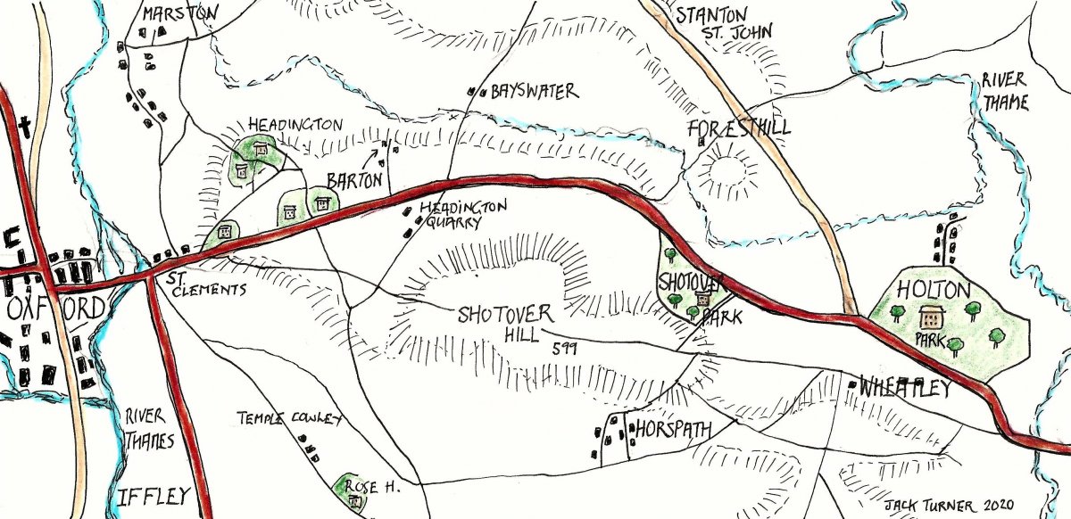
The route of the new red-coloured road into Oxford, now no longer a Turnpike, clearly runs along the south side of Holton Park, which is still partially delineated today by the wall to this park along London Road. To the west, it runs north of Shotover Park, as does the current A40. Coaches would have made a small detour (down the track that runs between London Road and Church Road) into Church Road if they wanted to visit the Crown Tap.
The old route through along Wheatley High Street and over Shotover Hill is clearly visible, Also shown is the existence of a ‘dry’ route (avoiding the brook in the valley) around Wheatley to the south, up to Castle Hill, as it is now known, and crossing Ladder Hill, thence to Shotover Plain. There is now no evidence of the previous route to Forest Hill via Church Road, Westfield Road and across Shotover Park.